**Click on images to enlarge**
Project pond visualization.
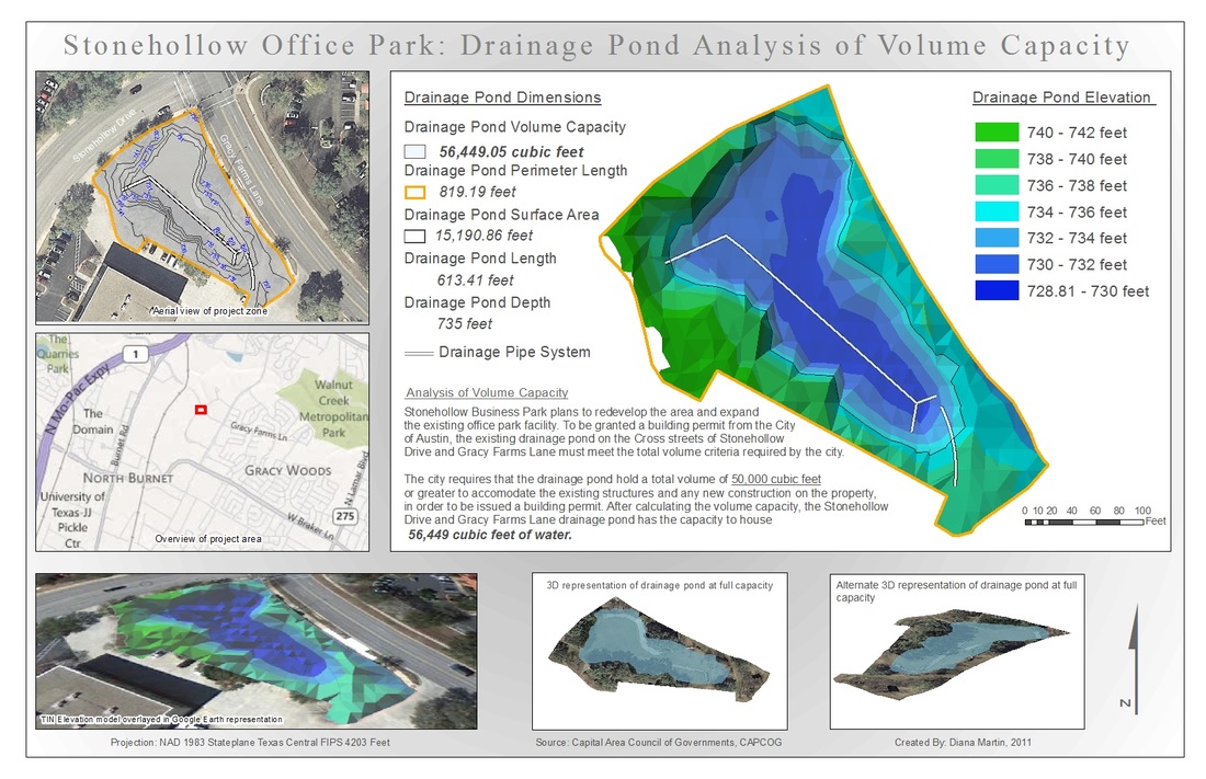
Required drainage pond hold a total volume of 50,000 cubic feet or greater to accommodate the existing structures and any new construction on the property. Analyzed volume of irregular drainage basin. Digitized pond boundaries, drainage boundaries from mass elevation points and LiDAR image, created elevation model and triangulated irregular network model and utilized ArcGIS 3D extensions to solve for volume of pond.
(Created July 2011)
(Created July 2011)
Copyright © 2013 DIANA MARTIN: Map Portfolio
Site Map
Site Map
