DIANA MARTIN: Map Portfolio
  • Home.
  • Map Gallery.
  • Portofolio.
    • Thematic. >
      • Project Food Atlas.
      • Project Pedernales.
      • Project Mapbook.
      • Project Islands.
      • Project Kentucky.
      • Project 5k.
    • Analytical. >
      • Project Food Mile.
      • Project Arlington.
      • Project Redistricting.
      • Project Grocery.
      • Project Onion Creek.
      • Project Jitney.
      • Project Pond Viz.
      • Project Zipcode.
      • Project Caldwell.
  • Education.
  • Experience.
    • Geographic Information Systems (GIS).
    • Environmental Studies.
    • Political Science.
    • Legal & Administrative.
    • Other Skills.
  • Resume.
    • Recommendations.
  • About Me.
  • Contact Information.

**Click on images to enlarge**

Project   Pedernales.

Created a redesign of a Hill Country region park from a Texas Parks and Wildlife map. Pedernales Falls State Park with added cartographic aspects contours, hillshade, use of cartographic representation and all original map information.
(Created November 2011)
Picture
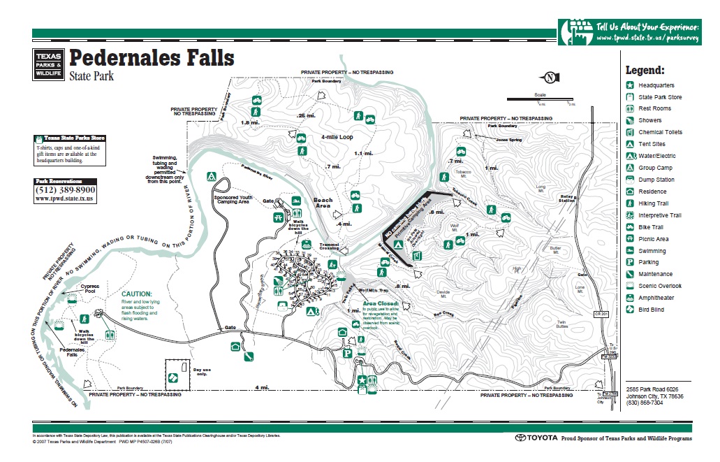
Original Texas Parks & Wildlife map
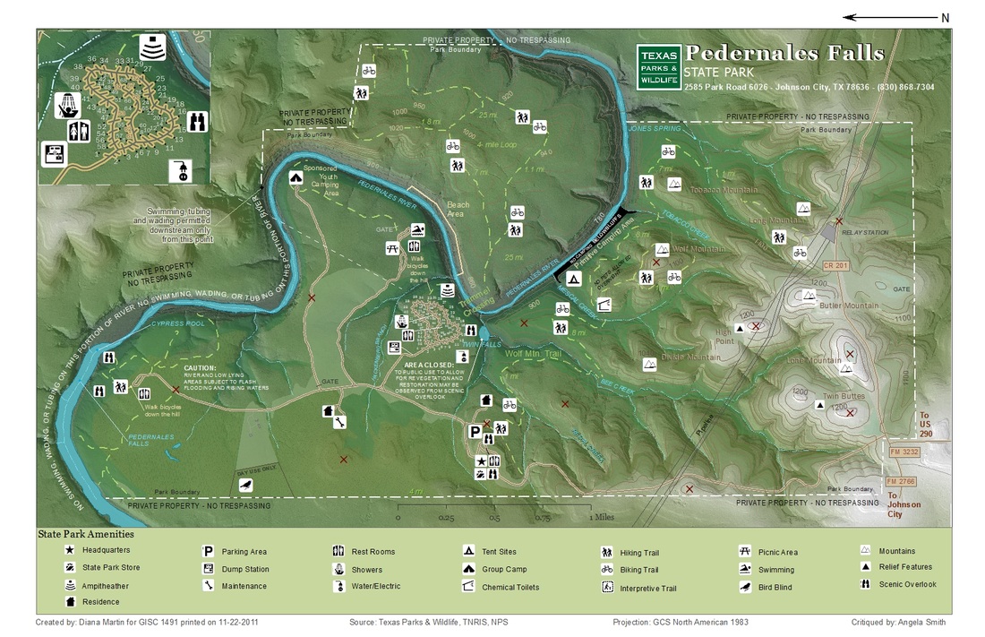
Picture
Redesigned park map

Copyright © 2013 DIANA MARTIN: Map Portfolio
Site Map
Powered by
✕